Travel Planner
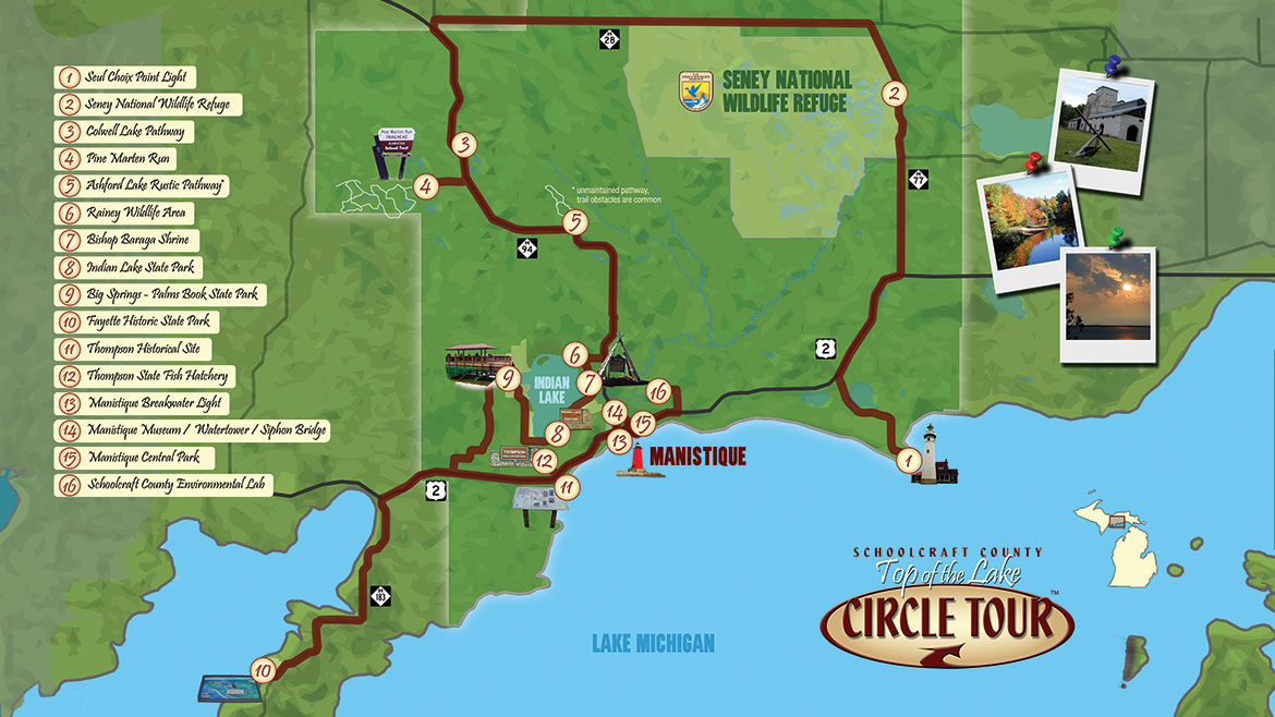
“Central Upper Peninsula Circle Tour”
Episode #2006 Travel Planner
Join Host Tom O’Boyle as he takes us on a tour of the central U.P. With stops from Fayette Historic Site all the way to the Seul Choix Point Lighthouse at the other end, and lots of cool places in between.
Guide
Tell us what you thought of this episode and get information about the areas featured by filling out the comment form
Comment Form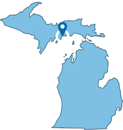
Schoolcraft County, Michigan
1 - Seul Choix Point Light
Location: 672 N West Gulliver Lake Road | Gulliver, MI 49840
Phone: (906) 283-3183
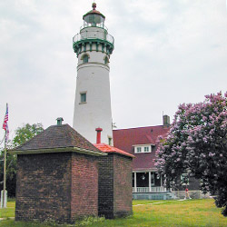
Seul Choix Point Lighthouse (pronounced SIS-SHWA) in nearby Gulliver, Michigan was built to light the way for the increasing number of vessels carrying the iron ore that was being shipped out of Escanaba, MI. Seul Choix Point Lighthouse is now a community park for everyone to enjoy. Built in 1895 this light, whose name is French for "only choice", was once the center of a thriving fishing community in the only harbor of refuge along this stretch of Lake Michigan. Today, the lighthouse complex is the only thing that remains active.
- Seul Choix Point Light [Visit Manistique]
2 - Seney National Wildlife Refuge
Location: 1674 Refuge Entrance Road | Seney, Michigan 49883
Phone: (906) 586-9851
Visitor Center: Open May 15th - October 20th | 9am - 5pm Daily
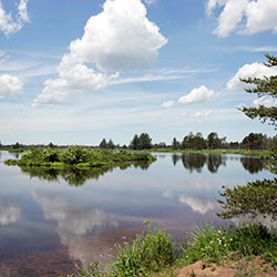
The refuge Headquarters and Visitor Center are located on Highway M-77 approximately 3 miles north of Germfask, Michigan and 15 miles northwest of Curtis, Michigan. It is one of the best wildlife excursions you can make, it is managed by the U.S. Fish and Wildlife Service. Seney National Wildlife Refuge is located in the east-central portion of Michigan’s Upper Peninsula, halfway between Lake Superior and Lake Michigan. The 95,238 acre refuge encompasses the 25,150 acre Seney Wilderness Area, which contains the Strangmoor Bog National Natural Landmark.
- Seney National Wildlife Refuge [Visit Manistique]
- Seney National Wildlife Refuge [U.S. Fish & Wildlife Service]
- Seney National Wildlife Refuge [Facebook]
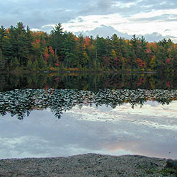
3 - Colwell Lake Pathway
Location: 30 Miles North of Manistique just off of M-94
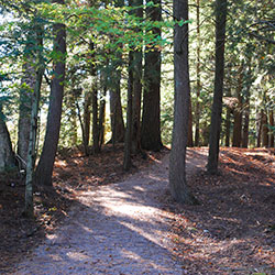
Colwell lake is 145 acres with an excellent swimming beach and boat access. Camping, fishing, picnicking and hiking are other popular recreation activities at Colwell Lake. The Colwell Lake Trail begins at the boat launch parking lot. This natural surface, nature trail is 1.6 miles long and crosses through a variety of northern hardwood stands and wetlands. The trail has several areas where stairs or plank boardwalks are traversed.
- Colwell Lake Hiking Trail [Hiawatha National Forest]
- Colwell Lake Trail Map [Visit Manistique]
4 - Pine Marten Run
Location: 30 Miles northwest of Manistique
East Trailhead: From Manistique drive north 22 miles on M-94 to County Road 437. Turn left (west) on 437 and drive 3.5 miles to the County Road 437 Trailhead.
Middle Trailhead: To reach the County Road 440 trailhead continue 1.7 miles south on 437 then turn right (west) on County Road 440 drive 1.4 miles to the trailhead.
West Trailhead: The Forest Road 2258 trailhead is best accessed from Forest Highway 13. From the intersection of FH-13 and US-2 drive 19 miles north on FH-13 to Country Road 440. Turn right (east) and drive 3 miles to FR 2258. Turn left (north) and drive 1.7 miles to the trailhead on the left (west) side of the road.
Pine Marten run is a 26 mile system of hiking and horseback riding trails located in the Ironjaw Semiprivate Area. Parking areas are available at each trailhead. And Adirondack shelters, with fire rings, have been constructed at Rim Lake, Rumble Lake and along the Indian River. Water and toilet facilities are available at the C.R. 440 trailhead, while the others only have toilet facilities
- Pine Marten Run Trail [Hiawatha National Forest]
- Pine Marten Run Trail [Visit Manistique]
5 - Ashford Lake Pathway
Location: 16 miles N of Manistique, MI
Ashford Lake Pathway is known more for its cross country skiing than its summer and fall hiking. That’s ok because that means its another secret that only a few know about. There are 3 Trail Loops of 3 Miles, 6 Miles, and 9 Miles
- Ashford Lake Pathway [Visit Manistique]
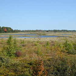
6 - Rainey Wildlife Area
Location: Dawson Road - Manistique, MI 49854
Directions: From US-2 in Manistique, drive north through town on M-94 about 5 miles to Dawson Road. Turn left (west) and proceed 1.5 miles to an access road that goes north to the site parking lot.
Size: 100 Acres
Phone: (906) 293-5131 Michigan DNR - Newberry Office
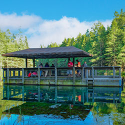
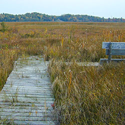
A hiking trail that passes through maple, yellow birch, and mixed conifer habitat takes hikers over boardwalks and through wet areas, leading to an elevated observation platform that provides a feeling of remoteness with outstanding opportunities for viewing wildlife.
- Rainey Wildlife Area [Visit Manistique]
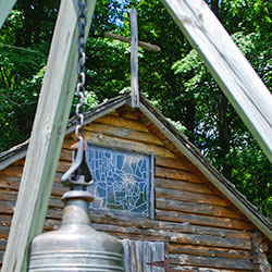
7 - Bishop Baraga Shrine
Location: Arrowhead Road on the East Side of Indian Lake 4.7 Miles NW of Manistique.
During his lifetime, Baraga founded many missions in northern Michigan. The original Indian Lake mission, the third of Baraga's faith, was built in anticipation of his first visit to the area in May of 1832. The chapel, built by local Chippewas, used traditional Indian construction methods and materials such as logs and bark. The Indians replaced the first chapel with a larger one in 1833. Records suggest that the chapel may have existed until 1873. Based on historical information, the Indian Lake mission was rebuilt in the early 1980's on the original mission's site.
- Bishop Baraga Shrine [Visit Manistique]
8 - Indian Lake State Park
Location: M-149 (a mile north of the Co Rd 455 junction) | Manistique MI, 49854
Approximate Size: 388 Acres
Phone: (906) 341-2355
Palms Book is a rewarding side trip for the vacationer touring the Upper Peninsula, for here can be seen one of Michigan's alluring natural attractions -- Kitch-iti-kipi, The Big Spring. Two hundred feet across, the 40-foot deep Kitch-iti-kipi is Michigan's largest freshwater spring. Over 10,000 gallons a minute gush from fissures in the underlying limestone. The flow continues throughout the year at a constant 45 degree Fahrenheit. By means of a self-operated observation raft, visitors are guided to vantage points overlooking fascinating underwater features and fantasies. Ancient tree trunks, lime-encrusted branches and fat trout appear suspended in nothingness as they slip through crystal waters far below. Clouds of sand kept in constant motion by gushing waters create ever-changing shapes and forms, a challenge to the imagination of young and old alike.
- Indian Lake State Park [Visit Michigan]
- Indian Lake State Park [Michigan DNR]
9 - Kitch-iti-kipi (The Big Spring) / Palms Book State Park
(Manistique, MI)
Palms Book has one of Michigan's alluring natural attractions -- Kitch-iti-kipi. Two hundred feet across, and 40-feet deep Kitch-iti-kipi is Michigan's largest freshwater spring.
- Palms Book State Park [Michigan DNR]
- Kitch-iti-kipi (The Big Spring) [Visit Manistique]
10 - Fayette Historic State Park
Location: 4785 II Road | Garden, Michigan 49835
Phone: (906) 644-2603
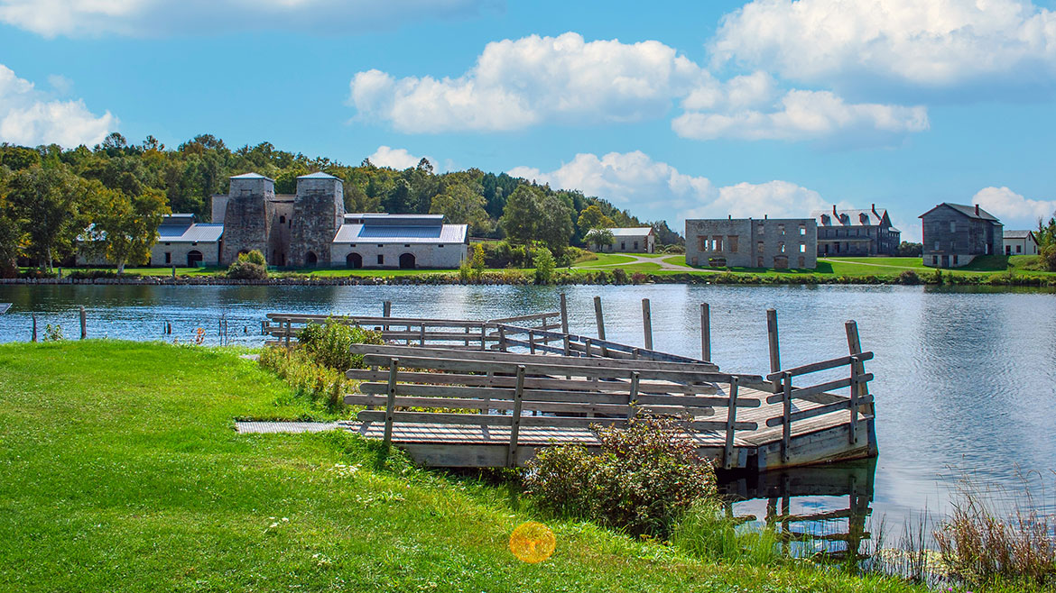
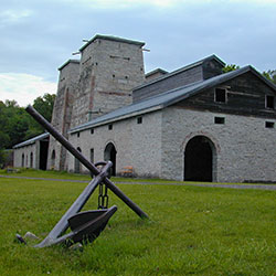
Fayette was once one of the Upper Peninsula's most productive iron-smelting operations. Located on the Garden Peninsula at Snail Shell Harbor. When the charcoal iron market began to decline, the Jackson Iron Company closed its Fayette smelting operation in 1891. It is now a completly restored village including 22 historic buildings, museum exhibits and the visitor center, which can be toured May through October. The historic site is located in Fayette State Park.
- Fayette Historic State Park [Visit Manistique]
- Fayette Historic State Park [Michigan DNR]
- Fayette Historic Townsite [Michigan History Center]
11 - Thompson Historical Site
(Thompson, MI)
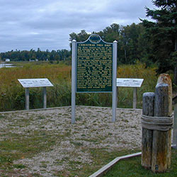
The silent stones of the dock are the final monument to the last port of call of the famous "Christmas Tree Ship", the Rouse Simmons. On November 22, 1912, she left Thompson Harbor loaded with Christmas Trees for Chicago. This site tells her story.
- Christmas Tree Ship [National Archives]
12 - Thompson State Fish Hatchery

Location: 944 South State Highway M-149 | Manistique, MI
Phone: (906) 341-5587
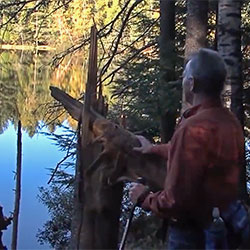
The Thompson Fish Hatchery is located about eight miles west of Manistique on County Road 149. It is one of six hatcheries operated by the Fisheries Division of the Michigan Department of Natural Resources and is open for tours. Most of the hatchery's annual production is cold water species such as brook trout, splake, brown trout, rainbow trout and chinook salmon most of which is planted in Upper Peninsula waters.
- Thompson State Fish Hatchery [Visit Manistique]
- Thompson State Fish Hatchery [Michigan DNR]
13 - East Breakwater Light & Manistique Boardwalk
Location: LAT 45.944786 LONG -86.247654 (Manistique, MI)
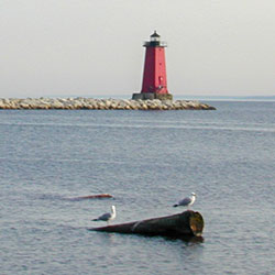
The Manistique Breakwater lighthouse is located in the harbor of Manistique, Michigan. It is listed on the National Register of Historic Places. The Boardwalk runs down the Lake Michigan shore in the town of Manistique. Go for an early morning walk or take an afternoon and picnic in the park. You can view the Manistique Lighthouse or ships passing by. It is a wonderfull way to spend a day.
- Manistique East Breakwater Light [Visit Manistique]
- Manistique Boardwalk [Visit Manistique]
14 - Manistique Water Tower / Schoolcraft County Museum / Siphon Bridge
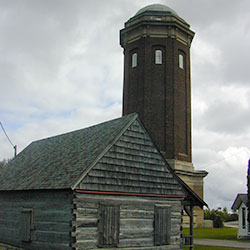
Location: River Street - Manistique, MI
Schoolcraft County Historical Park, Museum, and 200' tall brick Water Tower was built in 1921-22. Located on M-94 (River Street) at the Siphon Bridge in Manistique. The Water Tower is on the National and State Registrar of Historic Sites. Museum is open during the summer months. The renovated building provides space for arts related public events and public rest room facilities while preserving one of Manistique's unique and historic buildings. This eight-span girder bridge is 296 feet long overall and is an unusual design in that the bridge is an integral part of a concrete raceway flume. Since the water level in the flume is actually above the level of the roadway, the bridge acts as a siphon, thus its nickname, Siphon Bridge.
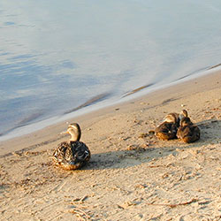
15 - Manistique Central Park
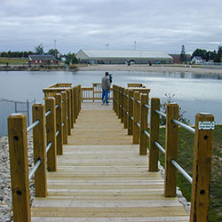
Location: next to Little Bear West Arena, 180 N. Maple St., Manistique
The 40-acre park which surrounds Manistique's quarry pond, has areas set up for a variety of summer and winter activities including a hill for sledding, an archery range, a walking and nature trail, a baseball field, basketball and tennis courts, picnic areas, swimming beach and fishing piers, with fish-stocked waters.
- Manistique Department of Recreation [City of Manistique]
16 - Schoolcraft County Environmental Lab
Location: 6 miles NE of Manistique at the end of Krumrich Rd
The Environmental Lab's purpose is for the environmental education of youths. The property is located within three miles of most of the county's schools and contains a wide variety of flora, fauna, topography, soils and stages of succession. Three state and federal grants, supported with local donations to match have allowed the project to develop and be successful. From Manistique, head East on US-2, turn left and head North on CR-433, turn left on KRUMMICH RD. (West) and follow until the road curves to the South and ends at the entrance of the Environmental Lab.
- Environmental Ecducation Lab [Visit Manistique]
Bonus Video (8:57)
Learn more about the creation, evolution and future of Manistique's Central Park in this un-aired interview with Recreation Board Chairman Michael Powers